
A Waterfront Vision Study for the town of Hastings-on-Hudson, NY
Can we build smarter at the water’s edge?
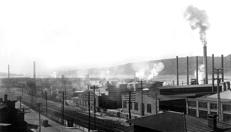
Building upon the findings of earlier Village committees, studies, and reports from the past decade, this project creates a holistic approach for this 42-acre Superfund site, harnessing its various environmental and resilience challenges as opportunities to develop forward-thinking strategies to maximize the site’s potential as a future public asset and activated neighborhood.
More information at Ennead Lab / In collaboration with Andrew Burdick, Albert Cua, Burak Unel and Don Weinreich
Aerial Perspective / Nova Concepts


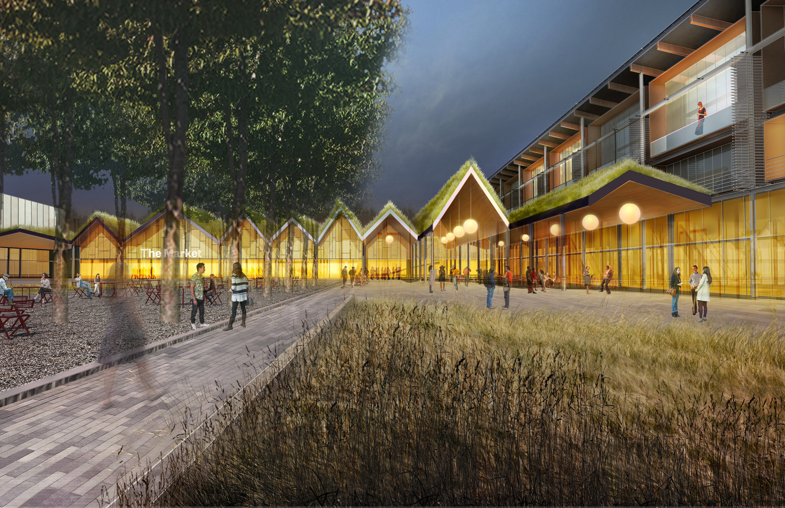
The Wharf
The northern portion of the site, the Wharf, is envisioned as a vibrant mixed-use district, a connection between the existing Village Downtown area and the Waterfront, and a series of flexible, human-scaled urban spaces that support a variety of formal and informal programs and uses, ranging from farmers markets and village fairs to weekend concerts and evening beer gardens. The design echoes the scale and rooflines of the site’s former industrial buildings, while also responding to the programmatic and environmental needs of buildings built for the 21st century.
With its proximity to both the existing MetroNorth commuter rail and potential new ferry service, the Wharf will become a welcoming front door and destination for Villagers and visitors alike.


The Wetlands
The southern portion of the site, the Wetlands, is conceived as an ecological neighborhood that utilizes the investments of new development to maximize the return of natural wetland habitat to this riverfront site, creating an interesting mix of urban living and natural environment. The design of the Wetlands embraces the potential of rising tidal levels, creating an inventive way to build and live at the water’s edge that is respectful of the site’s ecology and echoes many typologies of waterfront villages both historic and contemporary by creating an elevated level of public walkways that will foster interaction between neighbors and provide a resilient path to the adjacent high ground during storm surges and temporary floods, as well as in the event that rising tides permanently elevate the overall levels of the river onto the site.


